Green Island UAV Reality Capture and Laser Scanning
ESL have recently completed the data capture for the Green Island Heritage Site. This involved the integration of UAV photogrammetry and Laser Scanning.
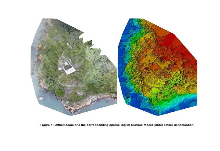
Following receipt of CAD flying permit data capture for both Aerial and Terrestrial was completed in 4 days. Production of BIM Model is now ongoing.