Company News
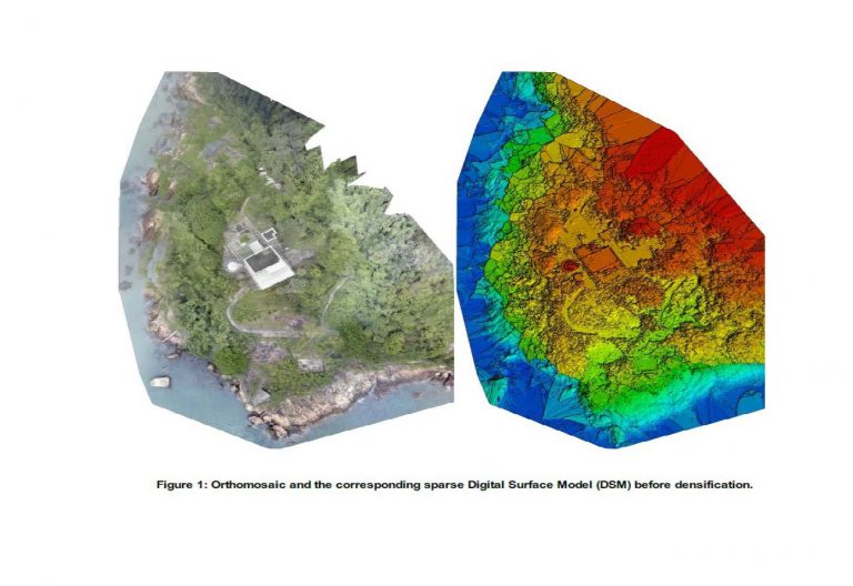
Green Island UAV Reality Capture and Laser Scanning
ESL have recently completed the data capture for the Green Island Heritage Site. This involved the integration of UAV photogrammetry and Laser Scanning.
Following receipt of CAD flying permit data capture for both Aerial and Terrestrial was completed in 4 days. Production of BIM Model is now ongoing.
Delivery of new Faro S150 Laser Scanner

Our new Faro S150 Laser Scanner has arrived and has been put to work.
It’s small size and mobility complements our Leica P20 scanner which together with our Faro Freestyle gives us great flexibility in choosing the right tool for the job.
Laser Scanning and scan to BIM is currently a growing market sector for ESL.
Industry News
3rd Runway Contract Award
ESL have been awarded Contract 3117 “Independent Geophysical Seabed Survey Services” by HK Airport Authority.
Dr Rosemary Quinn shall lead the team on this Project.
Company News
Paul Chan appointed as “Partner”
Paul Chan was appointed as our first “Partner” earlier this year (apologies for the late post).
Our intention is to use the “Partner” model (common with other professional service companies) to encourage a dynamic, go ahead culture within the business.
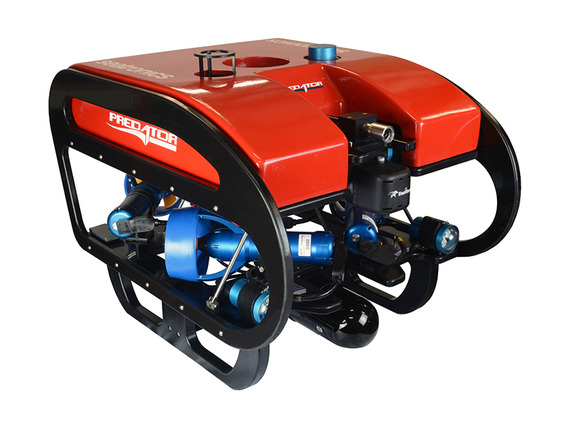
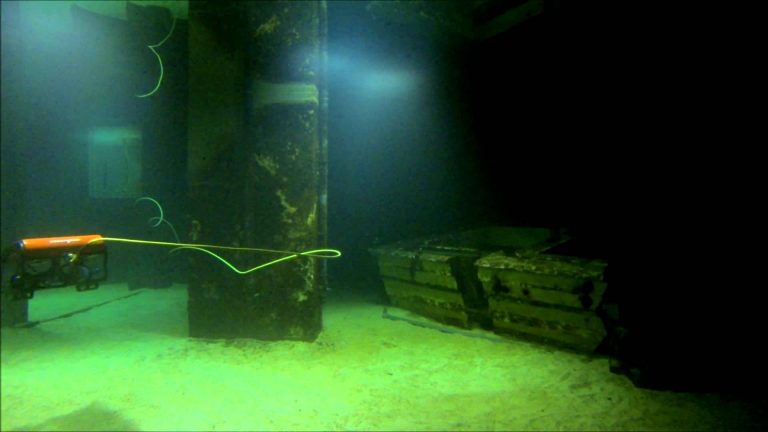
ESL purchase Inspection class ROV
ESL have recently purchased a Seatronics Predator inspection class ROV to add to our Hydrographic suite. This shall be used for underwater inspections up to 300m depth and shall complement our existing Multi Beam and Single Beam capability. ROV Training has been carried out at Seatronics Office in Singapore with Paul, Mike and Mathew attending.
Please contact Paul Chan at [email protected] for details and/or Quotation.
As an addition to our Tidemaster pressure sensor Tide Gauge(s) we have also purchased a Tidemaster Radar Sensor allowing automatic Tide Readings where a pressure sensor cannot be deployed. As with the Pressure Sensor type the calibrated sea level is uploaded online in real time.
Navigation System for underwater gravel spreading
Engineering Surveys have recently completed the provision and commissioning of a navigation and control system for underwater gravel spreading.
More to follow….
Company News