


公司新聞
17.09.2025
04.03.2025
ESL enters strategic partnership bringing Artificial Intelligence solutions to our business
Engineering Surveys Limited’s AI Partnership with Pyramid Ai Engineering Surveys Limited’s strategic collaboration with Pyramid Ai has revolutionised our onsite operations by leveraging their specialized AI solutions tailored for the Architecture, Engineering, and Construction (AEC) industry. As early adopters of their proprietary AI assistants, which provide access to over 2,000 technical and safety documents, we’ve significantly reduced the time spent retrieving technical and compliance information. Additionally, their AI-driven Vision Safety Assessor has strengthened our site safety protocols, ensuring that the correct safety procedures are consistently followed. This partnership has delivered measurable benefits, including improved safety standards, cost reductions in technical and safety compliance reviews, and a notable boost in productivity across our operations. By continuing to collaborate with Pyramid Ai, we are positioning ourselves at the forefront of the industry—harnessing AI to enhance efficiency, improve safety, and enable our surveyors and engineers to focus on more strategic and value-driven work. If you would like to hear more, please reach out to us or Pyramid AI at https://www.pyramidai.io/
29.04.2024
Congratulations to Patrick, now a Chartered Land Surveyor
Congratulations to Patrick Kan who has recently been elected as a professional member of the RICS.
23.01.2024
ESL added to CAD list of Advanced Operations Permit Holders
ESL are happy to be added to the Civil Aviation List of Advanced Operations Permit Holders. The List can be found @ https://www.cad.gov.hk/documents/AOP_Holders.pdf
15.01.2024
ESL awarded Lantau Island Independent Geotechnical Monitoring Consultancy by MTRC
ESL are happy to announce the award of Consultancy Contract NEX/1110 “Independent Geotechnical Monitoring for Lantau” covering Tung Chung Extension, Oyster Bay Station projects with an Option for ARO Over Run Tunnel. ESL, as Lead Consultant, are pleased to be working again with Maxwell Geosystems on this, our 5th IMC Contract.
25.05.2023
20.10.2022
Notice of Office Relocation
Dear Our Valued Clients, Partners and Potential Customers, Please be informed that due to business expansion our company shall be relocating to a larger office located close to our current office in Cheung Sha Wan (see details below). Our new office is conveniently located a short walk from Lai Chi Kok MTR providing easy access to clients and is housed in a newly completed development. With effect from 01st November, 2022 Our New office address is: Unit 03 & 05, 20th Floor, Peninsula Tower, No. 538-548 Castle Peak Road, Cheung Sha Wan, Kowloon, HK The main telephone no. (852) 2450 4088,mfacsimile no. (852) 2450 4663 & email addresses remain unchanged. During the relocation period, should you encounter any difficulties in contacting us via email and land-lines, please contact the person’s mobile phone number directly. I would like to express our continued gratitude and sincere thanks for all the support and cooperation you have given us over the past years. We look forward to a continued and prosperous relationship with our clients and partners in business, and wish you all the best in the coming year. Yours Sincerely. Gordon Ferrier FRICS, MHKIS, MHKinstES, RPS(Land Survey), CIC Certified BIM Manager Director
13.10.2022
Delivery of NavVis VLX 2nd Generation Mobile Scanner
Engineering Surveys have recently taken delivery of a 2nd Generation NavVis VLX Mobile Scanning System and have put it to work on two current projects. The results to date are extremely impressive both in terms of the absolute point cloud accuracy and the resolution achievable in a short observation period. The “richness” of the point cloud and lack of noise makes the output extremely easy to use for Scan to CAD or Scan to BIM applications…… More to follow.
21.09.2022
Passing Off by Newly Created Company
It has come to our attention that a company has recently been registered with a very similar name to our own. This company has been passing off the work of Engineering Surveys Limited as their own via a marketing flyer which claims experience and a history of work over a period of some 10 years which they have no right to do. We have demanded via a legal letter that this unprofessional practice cease immediately and assurances that it will not be repeated in the future.We have to this date received no assurances as demanded and have therefore written to our clients, partners and colleagues to make them aware of this situation. We further reserve the right to take further action, both legal and professional as required. Declaration for Passing off Company
15.08.2022
Congratulations to Mike, now a Chartered Land Surveyor
Congratulations to Mike Au who has recently been elected as a member of the RICS.
11.09.2021
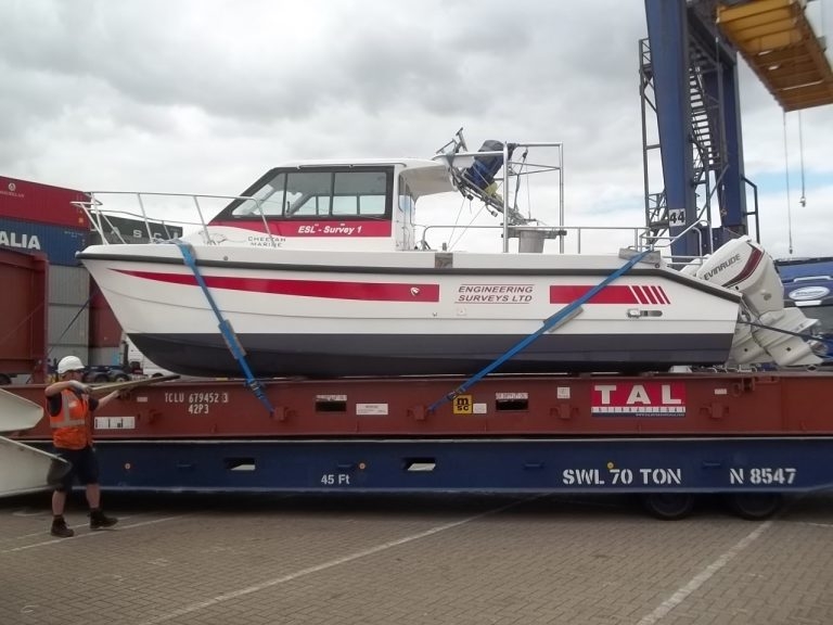
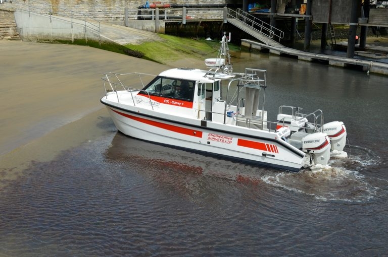
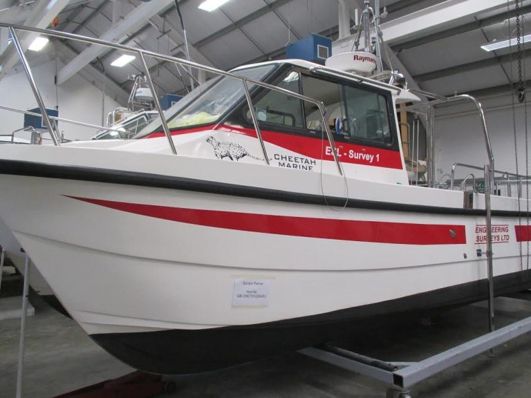
ESL Survey 1 Containerised for deployment anywhere
ESL Survey 1 can now be Containerised on a 20 foot Unit. This can be transported by standard container ship and on a normal sized Crane Lorry. This provides mobility for deployment anywhere at short notice. The Boat is an inshore shallow draft Catamaran with a full suite of Navigation, Bathymetric and Geophysical Sensors. Anywhere a 20 foot container can go our Survey Vessel can deploy. Along with experienced Crew and Technicians we offer a bespoke solution where previously only single beam boats could be used. Please use our enquiry email for a proposal and quote.
23.11.2020
ESL Survey 2 Annual Hull Cleaning
ESL Survey 2 with a new coat of paint
20.07.2020
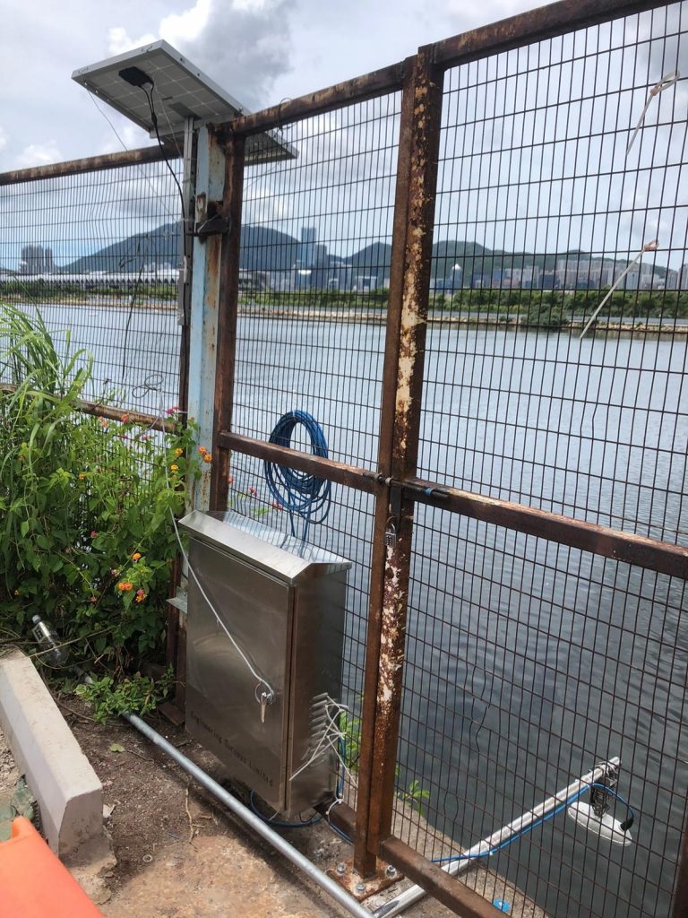
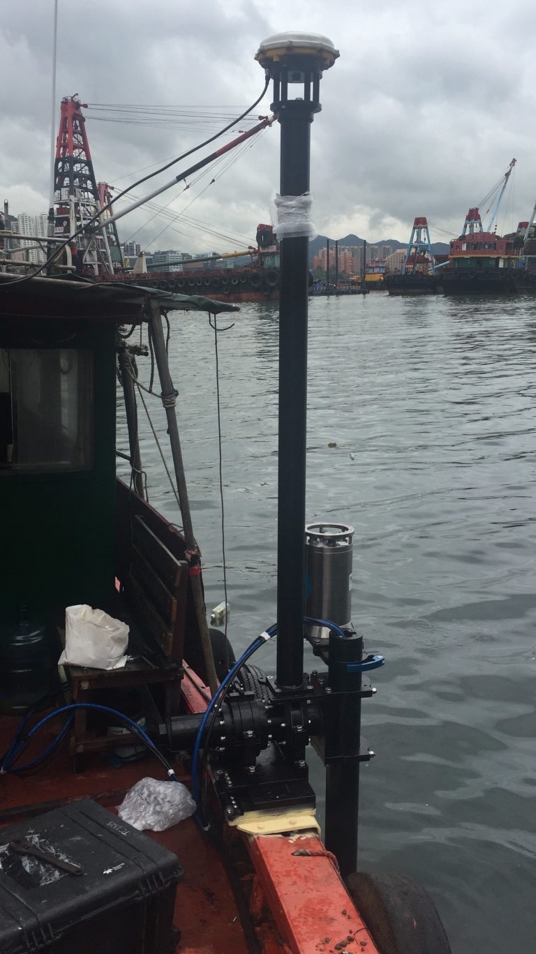
使用太陽能板安裝新的雷達潮汐表
我們的水電團隊最近安裝了新雷達式潮汐計,以提供即時潮汐資訊。 潮汐數據即時上傳到安全網頁,同時透過太陽能板供電。
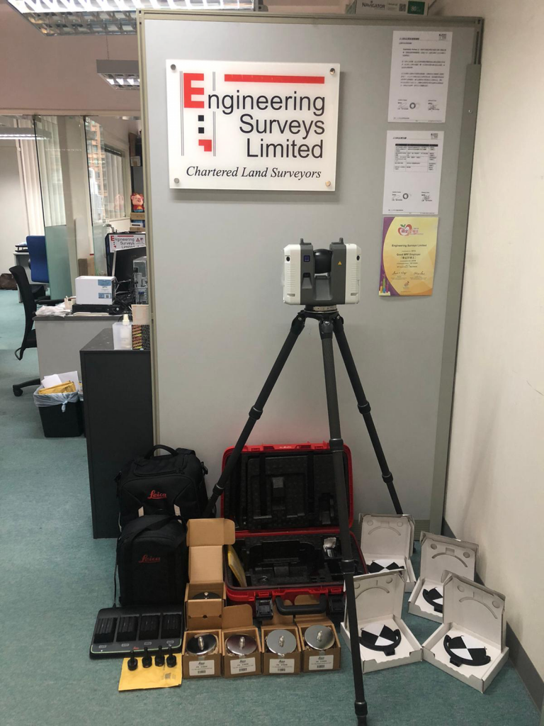
02.07.2020
ESL交付的最新的徠卡RTC360掃描儀,這是市場上最快的測量級設備
6月底,我們接收了新的RTC360地面雷射掃描器。 這是市面上最快的專業測量級掃描儀,每秒2,000,000點,完整的半球形掃描需要2分鐘。 此次購買意味著我們現在將有2台Leica掃描儀和2台Faro掃描儀,無論是在硬體功能還是在軟體適用性方面,都可以與任何項目的最佳掃描器相匹配。
04.06.2020
香港建造業議會(政府機構)認證的BIM專案管理經理
ESL董事長Gordon Ferrier獲得香港建造業議會BIM專案管理經理認證的。 這將有助於建立需要認證BIM經理目管理的專案。香港建造業議會目前是香港的認證機構。
26.02.2020
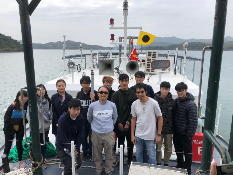
香港理工大學海道測量訓練營
公司團隊Paul, Jaden和Matthew最近於西貢, “ ESL二號測量船”上主辦了理工大學海道測量訓練營。 儘管有不合時宜的病毒,營地仍按計劃進行,並為所有人所喜愛。
21.02.2020
ESL二號測量船正在維多利亞港進行的移動檢查
10.02.2020
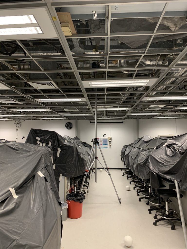
高層掃描器安裝座
ESL最近測試了一種高層(可達6m)的掃描器支架,用於掃描天花板空間的機電。可與ReCap“ Realview”結合使用,這對BIM建模有很大的幫助。
10.02.2020
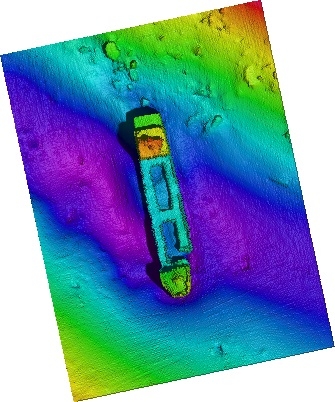
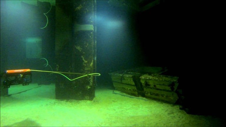
超高解析度多光束
使用我們的超高分辨率MBES在維多利亞港的25米深度處發現一隻沉船。
10.02.2020
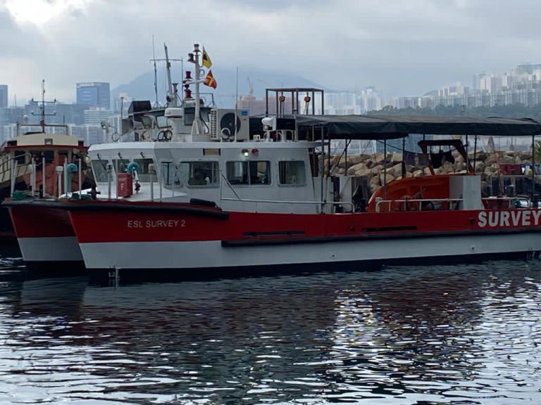
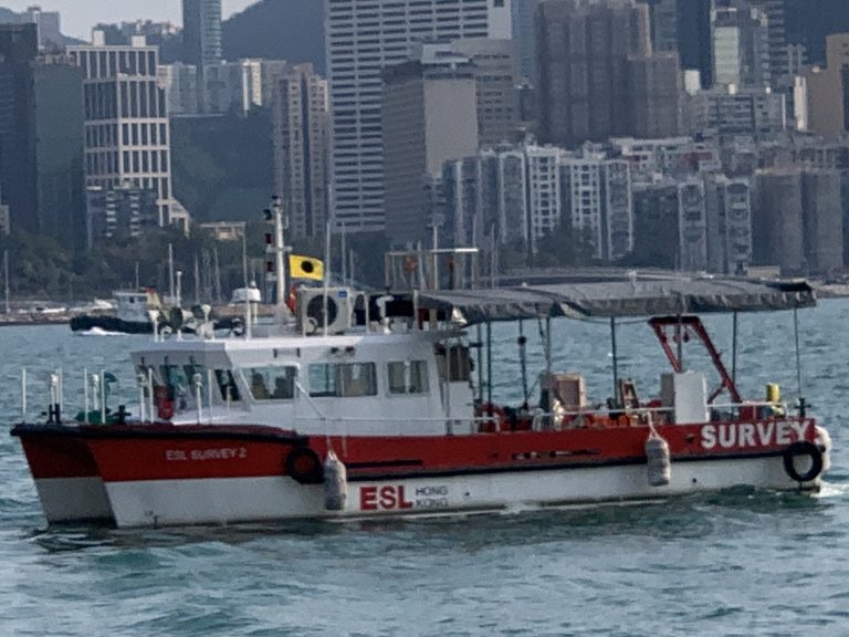
“ESL二號測量船” 到達香港
經過18個月的設計和在廣州建造,「 ESL二號測量船」已完成交付工作。 憑藉40平方公尺的後甲板,多個感測器支架和發射/回收系統,使ESL可以部署比「 ESL一號測量船」更廣泛的測量系統。我們的第一艘船仍將用於淺水測量,而如果需要多種感測器選項,例如多光束,無人機照相法和雷射掃描,則應使用二號測量船。 還有更多後續活動…
30.11.2018
RICS / HKIS重新開始相互認證
RICS和香港測量師學會(HKIS)共同宣布,今天(11月29日)兩個組織的專業人員相互認證。相互認證適用於土地測量組的專業人員。認證的細節如下。 HKIS會員被接納為RICS專業人士 HKIS土地測量師(FHKIS和MHKIS)的專業成員應向RICS申請後可被接納為RICS的專業成員(特許土地測量師(MRICS))並成為Geomatics專業組的成員,並有權RICS成員的所有特權受以下條件限制: A. 取得資格一年後,成為HKIS土地測量部門的專業會員,並從事與地理測量專業相關的專業實踐;和 B. 申請前成功完成RICS道德評估; C. 由RICS酌情進行的專業面試,以驗證申請人的能力和是否適合加入Geomatics專業小組。 RICS專業人士入選HKIS會員 RICS的專業會員(FRICS和MRICS)具有特許土地測量師的資格,其主要執業地點在香港,可應向HKIS提出的申請被接納為土地測量師的HKIS(MHKIS)的專業會員,並且可以是有權享有HKIS會員資格的所有特權,包括使用專業測量師的指定和指定稱呼,但必須:稱呼 A. 與香港測量師學會土地測量師相關的香港特許土地測量師資格及專業從業一年後;和 B. 由HKIS進行的專業面試,以驗證申請人的能力和是否適合進入該部門。 這種成員資格的相互承認不適用於HKIS土地測量部門或RICS Geomatics專業組的任何專業成員,而這些成員是透過與其他專業機構的互惠協議而被接納的。 成員資格的這種相互認可為專業測量師資格證書的申請流程提供了簡化,這將使測量專家能夠在本地和全球市場上進行實踐,並最終豐富他們的經驗並提高其在世界範圍內的專業地位。 有關申請的詳細資訊和查詢,請透過以下地址與RICS香港辦事處聯絡:e:ricshk@rics.org或電話:+852 2537 7117;或HKIS辦事處電郵:memdept@hkis.org.hk或電話:+852 2526 3679。 Clare Chiu大中華區營運長
31.10.2018
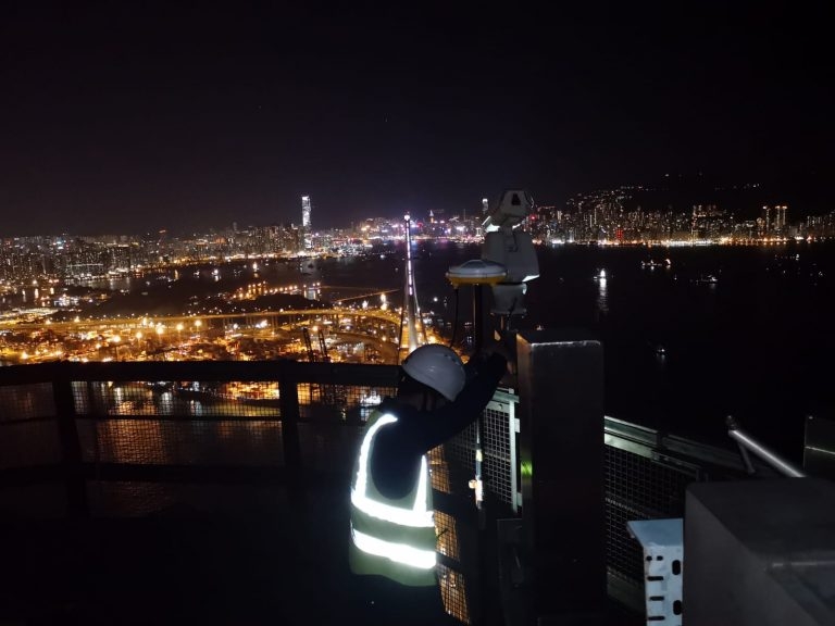
昂船洲大橋配置測量
Edward and Mike於2018年10月30日進行了昂船洲大橋塔頂GNSS配置測量。這是一個美麗的夜晚,幾乎沒有污染,如下圖所示。
30.10.2018
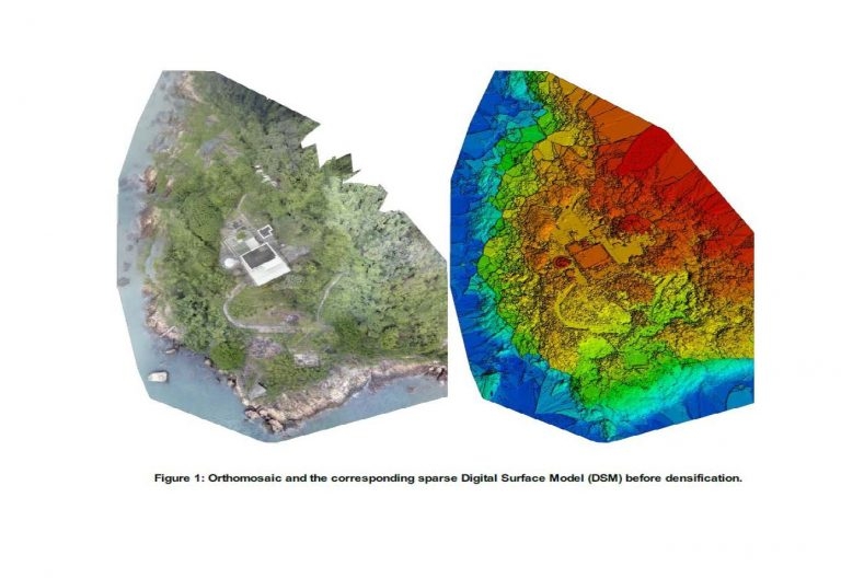
青洲無人機現實捕捉與雷射掃描
ESL最近完成了青洲遺址的資料收集。 這涉及無人機攝影測量和雷射掃描的整合。 收到民航局飛行許可證後,在4天內完成了空中和陸地資料的擷取。 BIM模型的生產正在進行中。
26.07.2018
新USM安裝調試
我們的水文團隊已成功使用Reson TP-50多光束,Octans 3000 IMU和Trimble GNSS調試並測試了新的通用聲納支架(USM)。
16.03.2018
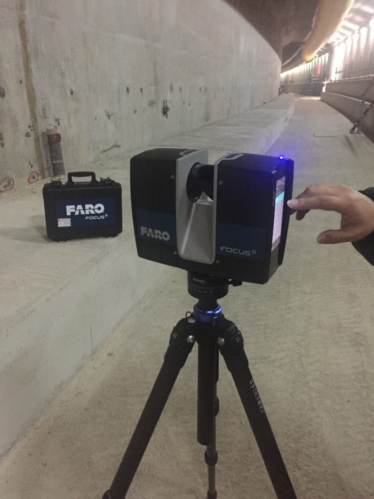
新型FARO S150雷射掃描儀的交付
我們的新型Faro S150雷射掃描器已經到貨並投入使用。 Leica P20掃描器體積小巧,移動性強,與我們的Faro Freestyle結合在一起,為我們選擇合適的工具提供了極大的靈活性。 雷射掃描和BIM掃描目前是ESL不斷成長的市場領域
30.01.2018
1121合約進展
「 ESL一號測量船」與即將沉管的最後一截預製單元E11並排。
04.12.2017
3RD跑道合約
ESL已被香港機場管理局授予3117號合約「獨立的地球物理海底測量服務」。 Rosemary Quinn博士將領導此專案團隊。
10.11.2017
香港政府推動BIM的採用
20.10.2017
ESL成功過渡到ISO 9001:2015
在成功過渡到ISO 9001:2015(原為9001:2008)之後,今天收到了電子證書。以下是國際標準組織(ISO)所製定的ISO 9001:2015的基本目標: ISO 9001:2015規定了組織在下列情況下對品質管理系統的要求: a)需要證明其持續提供滿足客戶以及適用的法律法規要求的產品和服務的能力,並且 b)旨在透過系統的有效應用來提高客戶滿意度,包括改進系統的過程以及確保符合客戶要求和適用的法律法規要求。 ISO 9001:2015的所有要求都是通用的,旨在適用於任何組織,無論其類型或規模或其提供的產品和服務。 感謝香港品質保證局,Paul Chan和我們所有為這項顯著成就提供幫助的員工。 以下是我們結合此更改的修訂徽標。
15.10.2017
2020年的施工–對測量員來說有什麼意義
請閱讀美國建築公司“ Bechtel”的以下文章 http://www.bechtel.com/about-us/innovation/project-2020/ 他們預測,到2020年,隨著人工智慧和無人機的採用,建築將朝著自動化的方向發展。 這種感測器依靠精確的地理空間定位,這對像我們這樣的公司來說是極為有利的。
14.10.2017
PAUL CHAN被任命為“合夥人”
Paul Chan於今年初被任命為我們的第一位「合夥人」。我們的目的是使用「合作夥伴」模式(與其他專業服務公司共同)來鼓勵企業內充滿活力的,不斷進取的文化。
13.10.2017
專業資格更新
ESL董事長(Gordon Ferrier)先生最近被選為皇家特許測量師學會(RICS)資深會員。 Tina Tang 有 recently submitted her applications to begin her APC to both the RICS and HKIS. meanwhile.. Mike Au is currently preparing his critical analysis…..WATCH THIS SPACE
14.09.2017
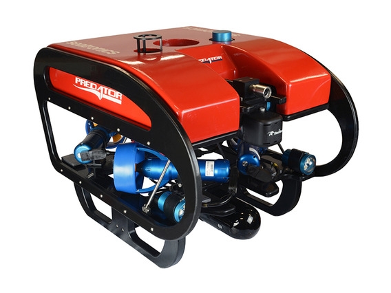
ESL採購觀察型ROV
ESL最近購買了Seatronics Predator觀察型ROV,以添加到我們的Hydrographic套件中。 它可用於深度達300公尺的水下檢查,補充我們現有的多光束和單光束測量能力。 在新加坡的Seatronics辦公室進行了ROV培訓,Paul,Mike和Mathew參加了培訓。請透過klchan@engsurveys.com.hk與Paul Chan聯繫,以獲取詳細資訊和/或報價。 除了我們的Tidemaster壓力感測器潮汐計外,我們還購買Tidemaster雷達感測器,可在無法部署壓力感測器的情況下自動讀取潮汐讀數。 與壓力感測器類型一樣,校準後的海平面即時在線上傳。
24.06.2017
水下礫石自動鋪設的導航系統
ESL公司最近完成了水下礫石自動鋪設的導航和控制系統的調試。 還有更多後續活動…。
14.04.2017
點雲視覺化工具
ESL目前正在使用點雲視覺化工具,以便與客戶分享掃描數據,並允許客戶跟進進度。 這裡查看點雲
29.01.2017
ESL購買LEICA INFINITY軟體
ESL最近購買了Leica Infinity軟體,以取代Leica GeoOffice。 Infinity讓我們可以使用GPS / Glonass / Gallileo / Baidou和QZ衛星資料處理GNSS資料。