Congratulations to Patrick Kan who has recently been elected as a professional member of the RICS.
Category: Company
Company News
Delivery of NavVis VLX 2nd Generation Mobile Scanner
Engineering Surveys have recently taken delivery of a 2nd Generation NavVis VLX Mobile Scanning System and have put it to work on two current projects.
The results to date are extremely impressive both in terms of the absolute point cloud accuracy and the resolution achievable in a short observation period. The “richness” of the point cloud and lack of noise makes the output extremely easy to use for Scan to CAD or Scan to BIM applications…… More to follow.
Congratulations to Mike, now a Chartered Land Surveyor
Congratulations to Mike Au who has recently been elected as a member of the RICS.
CIC Certified BIM Manager
ESL Director Gordon Ferrier has been added to the list of CIC Certified BIM Managers.
This will assist in projects where the BIM component requires a Certified Manager. CIC are currently the certifying body in HK.
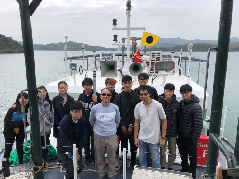
HK Polytechnic University Hydrographic Survey Camp
Paul, Jaden and Matthew recently hosted the Polytechnic University survey camp in Sai Kung on board “ESL Survey 2”. Despite the untimely Virus the camp went ahead as scheduled and was enjoyed by all.
ESL Survey 2 arrives in Hong Kong
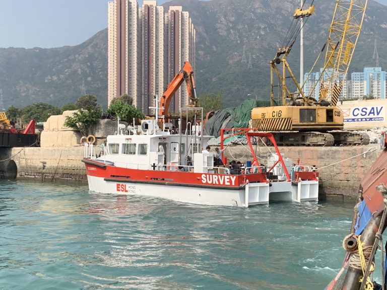
After 18 months Design and Construction in Guangzhou “ESL Survey 2” has been delivered.
With a 40 square meter back deck, multiple sensor mounts and launch/recovery systems this vessel allows ESL to deploy a wider range of survey systems than could be accommodated on ESL Survey 1. Our first boat shall still be used for shallow water surveys while “Survey 2” shall be utilised where multiple sensor options such a Multi-Beam, UAV Photogrametry and Laser Scanning are required.
More to follow…
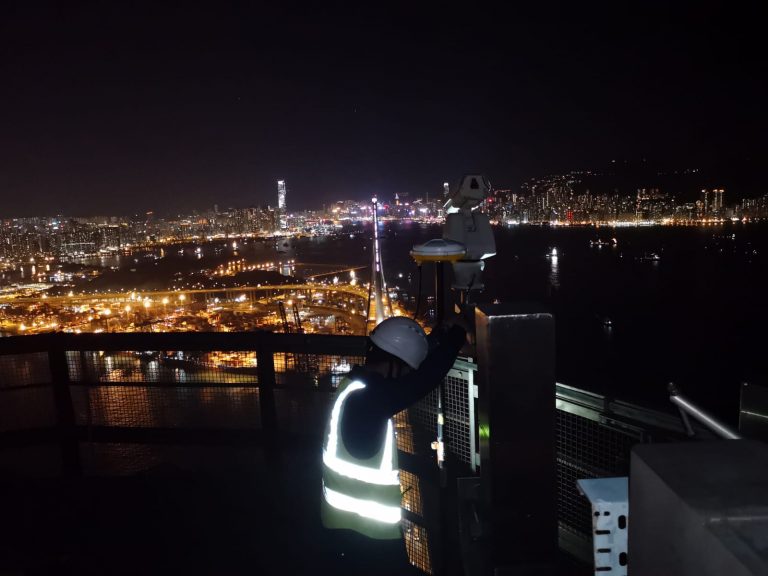
Stonecutters Bridge Configuration Survey
Edward and Mike carried out the SCB Tower Top GNSS configuration survey on 30th Oct 2018. It was a beautiful night with little pollution as can be seen from the photo below.
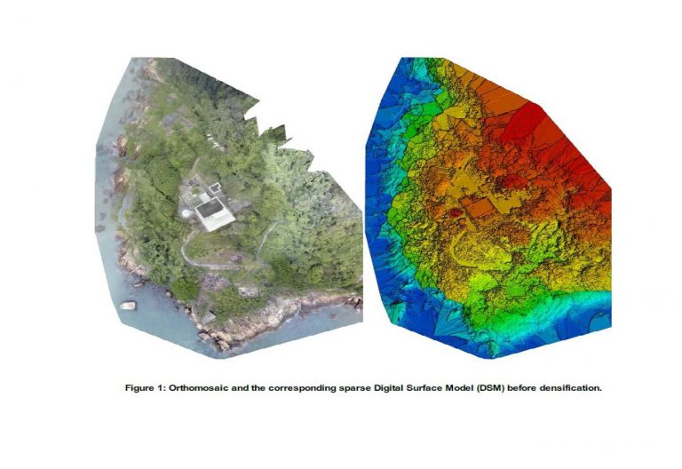
Green Island UAV Reality Capture and Laser Scanning
ESL have recently completed the data capture for the Green Island Heritage Site. This involved the integration of UAV photogrammetry and Laser Scanning.
Following receipt of CAD flying permit data capture for both Aerial and Terrestrial was completed in 4 days. Production of BIM Model is now ongoing.
Delivery of new Faro S150 Laser Scanner

Our new Faro S150 Laser Scanner has arrived and has been put to work.
It’s small size and mobility complements our Leica P20 scanner which together with our Faro Freestyle gives us great flexibility in choosing the right tool for the job.
Laser Scanning and scan to BIM is currently a growing market sector for ESL.
3rd Runway Contract Award
ESL have been awarded Contract 3117 “Independent Geophysical Seabed Survey Services” by HK Airport Authority.
Dr Rosemary Quinn shall lead the team on this Project.